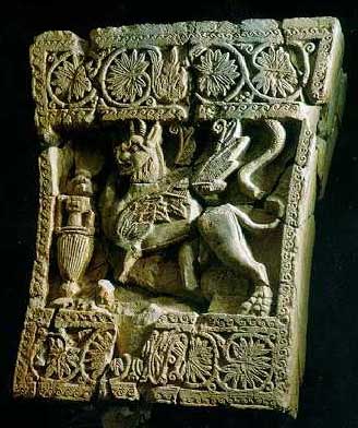
 In antiquity, the Greeks and Romans referred to the pre-Islamic kingdoms of ancient Arabia as “Arabia Felix” or “Arabia the Blessed,” due to their immense wealth and political power. Flourishing along caravan and maritime trade routes for over a thousand years, these kingdoms achieved impressive feats in technology, engineering, and the conservation of natural resources.
In this exclusive interview, James Blake Wiener of Ancient History Encyclopedia (AHE) speaks to Dr. William Glanzman, one of the world’s leading experts on ancient Arabia, about the importance of these polities as well as recent archaeological discoveries in southern Arabia.
JW: Dr. Glanzman, I thank you for speaking to Ancient History Encyclopedia! I wanted to commence this interview with a question about the caravan trade routes that traversed the Arabian Peninsula; from c. 1200 BCE-600 CE, the Arabian kingdoms of Saba, Himyar, Qataban, and Aswan dominated the trade of spices, perfumes, alabaster, balsam, myrrh, and especially, frankincense.
How did these kingdoms solidify a virtual monopoly on the trade of such items? If I am not mistaken, geography and climate facilitated their economic dominance.
WG: You are quite right, James; the location of, and climate zones occupied by, the ancient South Arabian kingdoms have a lot to do with their rise to importance. Geographically — and by extension most scholars would agree, politically — it is virtually impossible for any commercial activity to have occurred within the region of South Arabia without one having to cross through at least two or more of those ancient kingdoms. The deserts of the Rub’ al-Khali and its southern extension, the Ramlat as-Sabatayn, known in medieval times as the “Sayhad Desert,” were formidable arid expanses, where water and fodder for camel caravans could be found in sufficient quantities only in certain locations at specific times of year.
The issue of the origin of the “incense trade” is still unresolved, and the data used by most scholars to argue a position are strictly based on three specific criteria: arguments concerning the origin of the ancient South Arabian alphabet; textual references, especially in the Old Testament; and the presence of camel bones in archaeological contexts at sites located in southern Israel. So far, the full array of analyses that must be undertaken to determine the origins of the use of camels and camel caravans, and hence the ability of communities in South Arabia to engage in overland camel caravan commerce, has yet to be undertaken. There are also a few other issues that revolve around the specific commodities that were conveyed by those caravans, in addition to the rulers and kingdoms involved.
The first kingdom we are aware of that seems to have engaged in camel caravan commerce is that of “Sheba” as recounted in the Old Testament, I Kings 10 and the parallel passage in II Chronicles 9. Linguistically, the kingdom’s name in Hebrew is equivalent to the ancient South Arabian word SB’, rendered as “Saba’.” We should note that there is no ability to connect the story recounted in the holy book of Ethiopia, the Kebra Nagast, as its earliest compilation seems to predate c. 1400 CE, possibly extending back at least two or three centuries earlier in fragmentary form. In the Old Testament, we also must consider the words translated as the specific commodities carried by the Queen of Sheba’s entourage when she visited King Solomon (c. 970-931 BCE).
The word that is usually translated as “spices” in Hebrew is besamin, which refers, instead, to the word from which we derive the term, “balsam.” It is only once we have textual references to and archaeological evidence of commerce in herbs and spices, which occurs during the days of the Roman Empire, that those phrases should be used.
The only way that one can address the means and related factors about the “monopoly” of commerce in perfumes, balsam, myrrh, and frankincense, by various South Arabian kingdoms, is to have both clear textual references as well as corroborating archaeological evidence. The monopoly might be somewhat of a creation from the limited evidence we do have, such as the explicit mention of the kingdoms involved in Pliny the Elder’s Historia Naturalis (“Natural History”), and the kingdoms implied by the mention of the names of kings within the anonymous text, Periplus Maris Erythraei (“Circumnavigation of the Red Sea”). In Pliny’s text, the kingdoms of ‘Awsan and Qataban are not mentioned, while we do have reference to the Homeritae (Himyarites) and the Sabaoi (Sabaeans) in the Periplus.
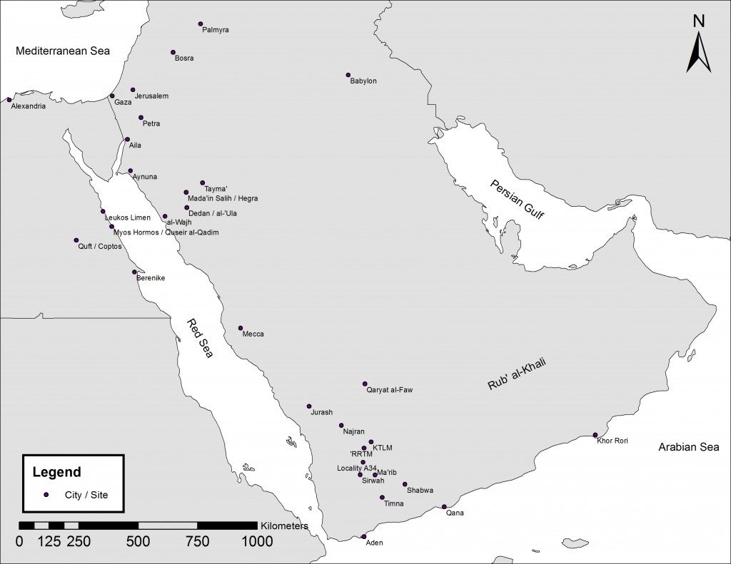
Incidentally, we do have several explicit mentions of commerce in aromatic substances, yet only in rather late times. For example, we have the famous “Palmyrene Tariff Law” of 137 CE, once affixed to the wall of the agora of the famous “caravan city” of Palmyra in the Syro-Arabian Desert. (Today, it is in the State Hermitage Museum in St. Petersburg, Russia.) It specifically mentions alabaster vessels as well as containers made out of animal hide that conveyed frankincense and myrrh products; the alabaster containers certainly held the oil extracts. The places of origin of these commodities, however, are not mentioned.
The only other such text that we have in the ancient Near East is the “Market Code of Qataban,” which was excavated in Tamna` and recently restudied by the French Archaeological Mission. It lacks the details of the “Palmyrene Tariff Law,” yet it does mention Qatabanians, Minaeans, and other denizens of Tamna`, who plied their trades from the houses surrounding the central market place of the city. They also mention that such commerce was regulated by Qatabanian authorities. Unfortunately, no commodities are specified. Furthermore, unlike the “Palmyrene Tariff Law,” no containers have yet been mentioned among the many thousands of texts written in the various forms of ancient South Arabian languages.
As far as I am aware, there are no published texts from South Arabia that specifically refer to any commerce in alabaster — either as a raw material or as a container for any commodity — although many examples have been recovered from countless excavations in the region. Perhaps our knowledge will change in the future, once we can return to all of the countries involved in camel caravan commerce, and conduct more intensive surveys and excavations in the region.
JW: Dr. Glanzman, could you tell us a bit more about the Sayhad Desert? How was it able to sustain successive flourishing civilizations in South Arabia?
WG: The Sayhad Desert extension is really a large basin enclosed on the west, south, and east sides by various mountain ranges. The famous five Arabian kingdoms originated in wadi systems (dried-up river beds that flow with water only during the two rainy seasons) around the Sayhad Desert. In antiquity, each major wadi (Arabic plural: widyan) was under the control of a single ancient South Arabian kingdom. The widyan emanate from the largely tree-less, rocky slopes and flow downstream into various channels, most of which flow into the Sayhad drainage basin. There are no streams or rivers that flow year round in South Arabia.
Around the basin’s large wadi systems are located the famous five kingdoms of South Arabia: Saba’ with its capital city of Ma’rib located in the Wadi adh-Dhana; Qataban with its capital city of Tamna` located in the Wadi Bayhan; Hadhramawt with its capital city of Shabwa located in the Wadi Hadhramawt; Ma`in with its capital city of Qarnaw located in the Wadi al-Jawf; and ‘Awsan located in the Wadi Markhah. The Kingdom of ’Awsan has always presented a problem as we are not certain of its capital city, and therefore we know little about its history. The kingdom of Hadhramawt certainly has the latest history by inscriptions, yet its origins are not clearly known. A sixth kingdom, Himyar, arose later around c. 110 BCE; its genesis was in the mountainous terrain above the Red Sea, and its capital city was Zafar.
The three best known kingdoms are those of Saba’ (the Sabaean Kingdom), Qataban (the Qatabanian Kingdom), and Hadhramawt (the Hadhramitic Kingdom). The Sabaean Kingdom is most famous because of the connection to the enigmatic Queen of Sheba and its mention in the Qur’an. It is also the earliest datable kingdom with a rather long list of rulers known originally as a mukarrib (“confederator”) and later as malik, the Semitic language term for “king.” Ma’rib seems to have arisen as its capital city by at least the 12th-century BCE, if not earlier (although the dates are still debated among scholars). It was certainly occupied by c. 2200 BCE, according to radiocarbon dates from the anthropogenic (“man-caused”) sediments at its base, obtained by the German Archaeological Mission (Deutsches Archäologisches Institut, DAI).
The kingdom of Hadhramawt, especially the capital city of Shabwa, has a long history of exploration by the French Archaeological Mission, and its radiocarbon dates go back at least to the 14th-century BCE, if not earlier. Both Ma’rib and Shabwa have similar pottery and other remains in their earliest occupation levels, as do other major sites in the region: Hajar Ibn Humayd in the Wadi Bayhan; Hajar ar-Rayhani in the Wadi al-Jubah (part of the Sabaean Kingdom); Raybun (part of the Hadhramitic Kingdom). The earliest occupation levels at Tamna` have not yet been explored, yet it flourished from the last several centuries BCE through at least the first century CE.
The Sabaeans were taken over in a joint political entity — at which time the king held the title “King of Saba’ and dhu-Raydan” (“Lord of Raydan”) — by the Himyarite Kingdom around c. 100-120 CE. That amalgamated kingdom lasted until the sixth century CE, while according to inscriptions and other ancient texts, it was the only South Arabian kingdom to last beyond the fourth century CE. The demise of the kingdom of Qataban is still not clear. The inscriptions unique to it and the external sources, such as the Periplus, seem to reflect one situation, while the continuance of occupation at its capital city of Tamna`, as determined by the French Mission’s archaeological fieldwork, seem to reveal a prolonged existence.
The Minaean Kingdom (Ma`in) was one of the best known of the famous five (Saba’, Qataban, Hadhramawt, ‘Awsan, and Ma`in). The last to appear and to have been mentioned in various inscriptions and external sources is that of Himyar, which originated in the coastal highland region of the present-day Republic of Yemen.
JW: Dr. Glanzman, you have spent a good deal of time in and around Ma’rib, the ancient capital of Saba. Ma’rib was a center of religious, commercial, and political activity for over a thousand years.
What first attracted you to this ancient Arabian city, and how can we characterize its importance?
WG: My first attraction to the capital city of the kingdom of Saba’ was also my first encounter in reading about the history and archaeology of the region about three decades ago. At that time, I was asked to be a member of an archaeological team that would go on to work in the nearby region of the Wadi al-Jubah, near the border between the former Yemen Arab Republic (YAR or North Yemen) and the People’s Democratic Republic of Yemen (PDRY or South Yemen). Once the team entered the field, we drove by and looked briefly at Ma’rib’s ruins. It was huge, with many fragments of stone masonry and inscriptions littering the surface of the immense tell that we believe was the acropolis of the Sabaeans.
The importance of Ma’rib is manifold. From a textual point of view, its importance in antiquity is certainly linked to both the Qur’an — suras and ayat: “The Ant” 27: 20-26; “Sheba” 34:15-17 — and later Arab folklore due to the collapse of the Old Ma’rib Dam and the hometown of the enigmatic “Queen of Sheba.” From a historical point of view, its importance would reside in the fact that it was the capital city of the kingdom of Saba’ and remains such for as long as we have written records of this kingdom as a separate entity. From the point of view of both epigraphy and history, it can be argued by the sheer number of inscriptions found within the site and around the territory it once controlled, as well as the information they provide on social organization and literacy, that this kingdom was certainly the most powerful for a very long time.
A number of scholars cite the unique attributes of Sabaean deities’ names and vocabulary, as well as syntax, as evidence for Sabaic as a separate language as opposed to a dialect of ancient South Arabian. From a technological point of view, its importance is demonstrated by the Old Ma’rib Dam and its vast network of irrigation canals and field systems, as well as the sophistication of the masonry skills and associated artwork. From an economic point of view, its importance is surely connected to its role in the network of camel caravan commerce, and how that tied into the rise and development of maritime traffic in various commodities.
JW: Not too far from Ma’rib is the Mahram Bilqis — also known as the “Awam Temple” — which was dedicated to the Sabaean moon god, Almaqah. For centuries, the sanctuary has been associated with the fabled Queen of Sheba — known as “Bilqis” in Arab folklore — and has only been excavated since the 1950s. No other location on the Arabian Peninsula has yielded such a vast array of pre-Islamic inscriptions, and the temple complex is the largest in Yemen.
What makes the Mahram Bilqis such a rich archaeological site, in your opinion? To what extent have recently uncovered artifacts given us a better understanding of ancient Sabaean culture and religion?
WG: Those are difficult questions to consider, as again this one sanctuary site is not only the largest we know of in the Yemen, but the largest we know of within all of Arabia. It has a very rich and complicated development, often discerned only through a very detailed study of inscriptions and associated archaeological evidence.
First, the name “‘Awam,” is often mentioned in the numerous inscriptions, in both votive offering and ex voto texts, as well as in various other dedication inscriptions. It seems to have a meaning of “pilgrimage,” which is attested directly by the names of individuals and the cities from which they hail, once they are buried in the southern portion of the sanctuary complex. Some of those places are known to be located far from Ma’rib itself; hence, many people in antiquity seem to have felt compelled to request burial rights in the ‘Awam cemetery, which forms the southern portion of the vast Mahram Bilqis complex.
Second, this site is composed of two major entities attested by some of the inscriptions found by the expedition launched in 1950 by the American explorer, Wendell Phillips: a sacred space or HRM (haram in modern Arabic) for the sanctuary itself and a sacred space for the cemetery. Both are integral to the nature and use of the site as the excavations of the DAI in the cemetery zone have revealed since the late 1990s. The sanctuary zone has been explored in part by the American Foundation for the Study of Man (AFSM) since 1998.
The studies of the inscriptions by late 19th-century explorers and those from more recent archaeological specialists reveal that the Sabaean deity, ‘Almaqah — represented by the crescent moon and the bull — was often invoked in various dedications and other texts along with a deity known as “‘Athtar” and sometimes with the goddess, Dhat-Himyam. Sometimes, just one of these deities — usually ‘Almaqah — is mentioned. Hence, we should think of this sanctuary as being dedicated to several deities of importance to the Sabaeans. While it is convenient to think of ‘Almaqah as the “moon-god,” we should actually think of him as an ancient “storm god.” Perhaps the most important discoveries, in terms of the site’s chronology, are two-fold, James.
One is the recovery of a single potsherd of a style known to have been restricted to the mid-second millennium BCE and shortly thereafter. The other is the presence of a Christian cross, in high relief, on a stone that was found in a looter’s pile of debris along the exterior of the Ovoid Precinct wall system. This data demonstrates an existence of use from approximately c. 1500-1200 BCE, possibly a religious association, and the continuation of the sanctuary as a holy place in the sixth century CE. If so, then the use of the sanctuary would endured longer than Christianity has on this planet! We do know that the Christian king Abraha (r. 525-c. 553 CE), the ruler of the kingdom of Axum (Ethiopia), repaired the Ma’rib Dam and also is said to have built a church at Ma’rib. The fragmentary cross might be the remnants of that church. What better way to introduce the power and authority of that religious order into Ma’rib than building a shrine or church at the major sanctuary of its most prominent pre-Islamic deity?
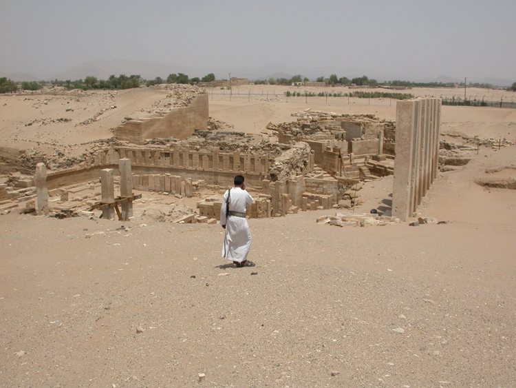
Besides the numerous inscriptions, social organization, and religion of the Sabaeans, I find some of the most fascinating discoveries to be those derived from excavation and the large-scale sub-surface survey we conducted in 1999 and 2000. The sub-surface survey data revealed part of the extent of the site and identified what seems to be a large processional way, which leads to what is identified as the Northwest Doorway. That doorway today is much narrower than it was in before c. 500 BCE, when the sanctuary’s entrance underwent a major realignment with the construction of the Peristyle Hall.
Perhaps most fascinating of all, however, are the miniscule details derived from careful excavation and recording of the wall systems for the Ovoid Precinct Wall, and its adjoining and adjacent structures. Those walls are all built with inner and outer faces in a “header-stretcher technique,” with cross-wall connections between the faces. The spaces between the faces were filled, at least in their later history, with soils containing numerous fragments of artifacts and ecofacts. (These are items from the natural environment). These associations indicate that the later walls were built after a lot of offerings had been dedicated to the deities worshiped here, and that there is at least one major “dump”– constituting the discarded remains of those offerings — somewhere nearby.
Once an offering or dedication is made to the deity (or deities) and given over to the sanctuary, it becomes the property of the deity; that is, it is something not to be violated by removal from the sacred space. This became clear when some students were working on the animal bones recovered from the fill of the wall systems and found animal bones with rodents’ teeth marks as well as manganese stains on them.
JW: The Greeks, Romans, Persians, Jews, and Abyssinians envied southern Arabia’s wealth and commercial might. Some inscriptions found in Yemen also attest to a Nabataean presence in the region. Furthermore, in 26-25 BCE, the Roman prefect of Egypt, Aelius Gallus, besieged Ma’rib with assistance from Nabataean camel riders.
Do we know anything about commercial, cultural, or political relations between the Nabataeans and the kingdoms of southern Arabia? Can one draw parallels between cosmopolitan Petra and mercantile Ma’rib?
WG: There are indeed some inscriptions in Arabia that are in the Nabataean script, especially in what is present-day northern Saudi Arabia, at the sites of Dumat al-Jandal, Tayma, and Mada`in Salih; they are also known from the caravansaray site of Qaryat al-Fau in central Saudi Arabia, although they have yet to be studied.
 However, only one was discovered in the Yemen, the fragmentary bilingual Nabataean-ancient South Arabian inscription discovered during the excavation of the ‘Almaqah Temple complex, at the site of Sirwah, by the DAI in Yemen. This bilingual text was recycled into a wall that was placed near the famous and much earlier pedestalled ancient South Arabian inscription of King Karab’il Watar I.
The bilingual text mentions one Nabataean king, Aretas IV Philopatris (r. c. 9 BCE-40 CE). Generally, one can assume that the presence of inscriptions in a script and language like Nabataean constitutes direct evidence of the presence of one or more Nabataeans in South Arabia. The question is really whether or not there are other lines of evidence for a Nabataean presence in South Arabia, and the answer is likely yes.
So far, the highly distinctive egg-shell thin painted pottery of the Nabateans has been found at three sites in South Arabia. Four potsherds of these wares were first noticed at the site of Khor Ruri, in the Dhofar region of the Sultanate of Oman, by Frank Albright during his excavations in 1952-1953. Other painted Nabataean wares have also been found among the disturbed debris of the ancient capital city of the Sabaeans, Ma’rib.
More recently, two sherds, both of which originally came from different bowls, have been discovered at the site of Jurash in the `Asir region of the Kingdom of Saudi Arabia by the University of Miami’s Jurash Project (on which I served as field archaeologist and ceramics specialist). Jurash, a hinterland site, was at some time late in its history connected to the overland camel caravan commerce between the Levant and South Arabia.
Taken together, these discoveries demonstrate that there was indeed a reason to export those unique painted wares, all of which derive from bowls. It can be argued that the South Arabian evidence refers to the presence of Nabataean elites at these commercial hubs and political centers. I would further assert that the Nabateans present were functioning as the equivalent to the Roman negotiatores, or “commercial agents.” It seems to me that a robust commercial interaction between the Nabateans and South Arabia existed — at least for the kingdom of Hadhramawt and the kingdom of Saba’ — at some point during the reign of the Nabataean King Rabbel II Soter (c. 70/71-106 CE).
Beyond those tidbits of data and interpretation, we will have to wait for the ability to return to conduct fieldwork in the Yemen in order to clarify further details about ancient camel caravans and their commerce.
JW: Dr. Glanzman, let us move on to your most current research, which has involved caravan tracking from Oman (Dhofar Project), through Yemen (Wadi Raghwan Archaeological Project, WRAP) and Saudi Arabia (Jurash Project), and finally terminating in Jordan.
Using satellite mapping — in coordination with traditional archaeological fieldwork — you have identified what appear to be “camel caravan way stations.” Could you share more information?
WG: Yes, indeed. Let’s focus on the Wadi Raghwan Archaeological Project (WRAP). On our last day of fieldwork in 2006 — it seems the best or most important discoveries frequently occur then — we encountered a massive, multi-component archaeological site (which we identify as Locality A 34). It consists of very long and relatively intact irrigation canals emanating from the main branch of the Wadi Raghwan and trending northeastward into a hidden valley, where they fed extensive field systems that today are found as raised silt beds. (This is just like those found at Ma’rib and elsewhere throughout the Yemen.) One branch of those canals fed a large rectangular stone-built cistern coated on its interior with the water-tight compound (known in Arabic as qudad), which is rather like the Romans’ hydraulic cement. Curiously, only a couple of domestic structures are present within this hidden valley.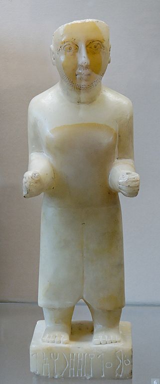
To the south of the cistern are two large rock outcrops. One of these structures is actually two contiguous long halls with massive interior stone pillars, which I believe can only be interpreted as massively built warehouses of at least two stories. Adjacent is a long walled open space, likely a corral of some sort, and a couple of other structures; one of those has a series of narrow rooms most similar to those found in the Yemeni funduq. (This is a hotel for males often found around traditional marketplaces). A similar but smaller complex is located at what appears to be a small pass through the rock hills, which forms the southern boundary of the hidden valley.
Taken together, the evidence from Locality A 34 suggests we have a major caravansaray. The artifacts found on this site, however, do not give away its age. My working hypothesis is that they belong to a way station that may have functioned long before Locality A 34 was active.
At both rock outcrops, there are many examples of rock art (petroglyphs) and wusum (tribal symbols). Scattered about the surface of both outcrops, especially the eastern one, are numerous fragments of sheep and goat bones, as well as pieces of alabaster. The latter was most likely derived from the known quarry at Jabal al-Manqaz to the south.
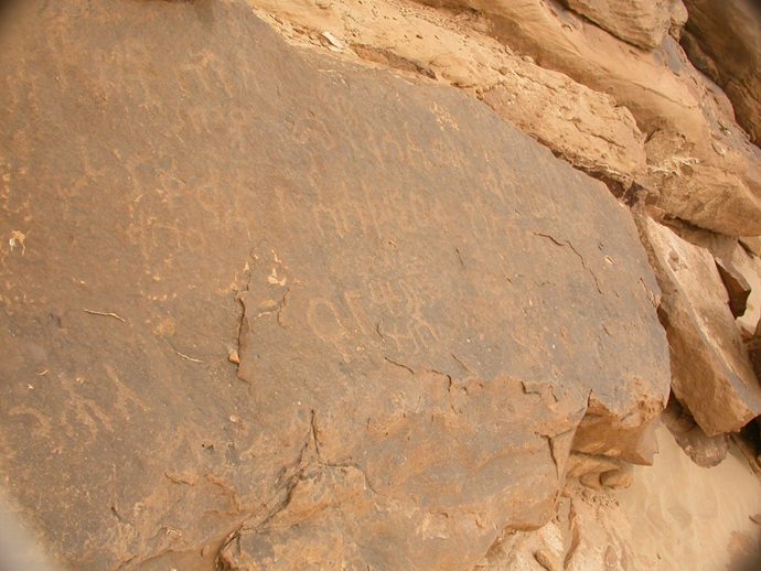
At another site there is a set of rock art and numerous graffiti in a very old Sabaic script near a large “balancing boulder.” Also present nearby are what appears to be a Bronze Age domestic structure (possibly dating within c. 2400-1800 BCE), an enigmatic wall system, as well as a number of burial cairns and a sandstone quarry. It seems likely the “balancing boulder” functioned as a landscape marker for persons traveling through the Wadi Raghwan to stop, rest, and possibly access some water. One of the signs present here is the so-called “water sign.”
Further north, near the confluence of the Wadi Raghwan with the Wadi al-Jawf, is the location of a site known since the days of Henry St-John Bridger Philby (1885-1960 CE), the famous and celebrated British Arabist: ancient KTLM, now the modern Khirbat Sa`ud. This site has been heavily looted over the years.
It has within its walls a sanctuary dedicated to several different deities, suggesting that it functioned as a way station as well as a frontier outpost between the Sabaean Kingdom and the Minaean Kingdom. On the exterior of the southern flank is a peculiar set of three walls forming a large U-shaped enclosure open to the south. Along its inner face are several small irregular structures delineated by single rows of stones. It seems most like the small local markets one finds in towns and villages throughout the Yemen today, replete with stalls. My working hypothesis is that this site served as a caravansaray and “last chance way station” before going into or coming back from Minaean territory within the Wadi al-Jawf. In antiquity, the site of KTLM and several others nearby were destroyed by fire and abandoned. The latest dated pottery on their surface seems to date around c. 500 BCE, give or take a couple of decades.
The site of Jurash, in the`Asir region of the Kingdom of Saudi Arabia, is best discussed within the context of the known changes in the overland routes, both pre-Islamic and for the development of the hajj routes, once Islam arose in the region in the seventh century CE.
JW: One should not forget that seaborne trade was salient a feature of ancient South Arabian life. 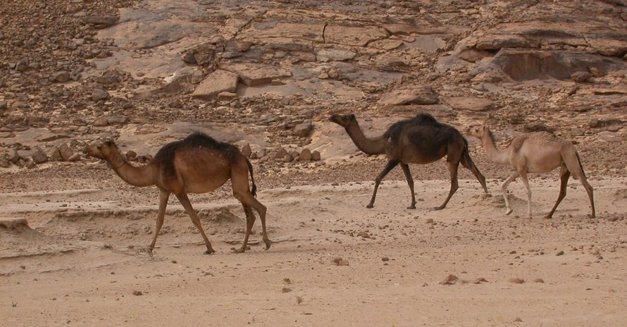 Did maritime trade and commerce develop concurrently with the caravan routes? Also, did different kingdoms favor one over the other?
WG: For a long time, scholars felt that the rise of maritime commerce with Arabia signaled the demise of overland camel caravan commerce. More recent field work as well a review of the ancient sources now demonstrate that there was instead a symbiotic relationship between ancient ports such as Khor Ruri and the major hinterland sites of Shabwa, Tamna`, Ma’rib, and Ma`in. We are also clearer on the correct date of the compilation of the Periplus: c. 50 CE. Incidentally, this correlates very well with the rise of ancient textual sources that describe details about Arabia’s camel caravan commerce.
We also know that the routes between those ports and the hinterland sites can be hypothesized with some degree of accuracy. We are working on GIS models of landscape analysis to suggest the most probable routes. The kingdoms of Hadhramawt, Qataban, Saba’, and Ma`in all interconnect, and the caravans had to traverse through several of those kingdoms’ boundaries in order to have enabled commerce between South Arabia and the Mediterranean markets. It is clear that maritime commerce did not displace camel caravans; rather, they both continued to operate although in a different and declining commercial market for the famous aromatic substances.
JW: Dr. Glanzman, It has been such a pleasure to share your passion for Arabia’s rich and remarkable heritage with our audience. I hope that you will keep us posted as to your latest news and think of us in the near future!
WG: Thank you! It would be my pleasure to do so.
Image Credits:
- A mythical griffin from the royal palace at Shabwa, the capital city of the kingdom of Hadhramaut, located in present-day Yemen. This piece dates to c. 250 CE. (National Museum, Aden NAM 1218.) Original uploader was Jidan at en.wikipedia, 2006-06-01. (The copyright holder of this work allows anyone to use it for any purpose including unrestricted redistribution, commercial use, and modification.)
- This map of the Arabian peninsula shows most of the important and well known archaeological sites associated with the overland camel caravan routes from South Arabia to Gaza, and even includes the ancient cities of Palmyra and Babylon. Well known maritime ports and the sites of the Wadi Raghwan region — KTLM (present-day Khirbat Sa`ud) and`RRTM (present-day al-Asahil) — are also indicated. These locales are being surveyed by the Wadi Raghwan Archaeological Project (WRAP). Image compiled and created by GIS specialist Ms. Jessica Paquette. (Permission to use image was granted by Ms. Jessica Paquette at Dr. William Glanzman’s request.)
- This is a large panel containing ancient South Arabian graffiti located in the Wadi Raghwan region of Yemen (Locality A 12). Photo taken by Dr. Bill Glanzman in 2006. (Permission to use this image was granted by Dr. William Glanzman.)
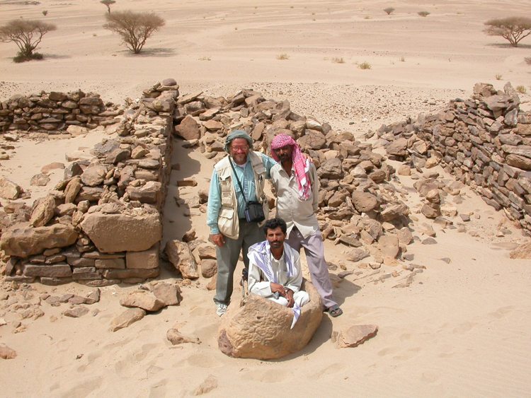
- Dr. William Glanzman taking a break from archaeological excavations in Yemen’s archaeologically rich Wadi Raghwan region. Photo taken by Dr. Glanzman’s surveyor, Mr. Sidney Rempel, in 2006. (Permission to use this image was granted by Dr. William Glanzman.)
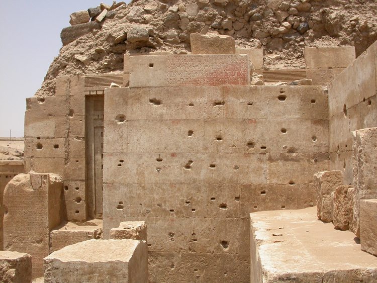
- Image of the inscription published by Mohammed Maraqten (2004) on a façade of the famous Mahram Bilqis in Ma’rib, Yemen. This temple, also known as the “Awam Temple,” is likely the largest pre-Islamic Sabaean temple in Arabia. Photo taken by Dr. Willian Glanzman in 2005. (Permission to use this image was granted by Dr. William Glanzman.)
- A view of Mahram Bilqis‘ Peristyle Hall and adjacent structures uncovered by the AFSM after 2001. One sees a site guard in the foreground and the curvilinear wall system of the Ovoid Precinct in the background. This is a view to west. Photo taken by Dr. William Glanzman in 2005. (Permission to use this image was granted by Dr. William Glanzman.)
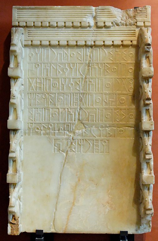
- Votive stele with a Sabaean inscription addressed to the moon-god and weather god, Almaqah. It mentions five other South Arabian gods, two reigning sovereigns, and two governors: “Ammî’amar son of Ma’dîkarib dedicated to Almaqah Ra’suhumû. With ‘Athtar, with Almaqah, with dhât-Himyam, with dhât-Ba’dân, with Waddum, with Karib’îl, with Sumhu’alî, with ‘Ammîrayam and with Yadhrahmalik.” Alabaster, c. 700 BCE, area of Ma’rib (?), Yemen. H. 96.5 cm (37 ¾ in.), W. 59 cm (23 in.), D. 15 cm (5 ¾ in.). Department of Oriental Antiquities, Sully wing, ground floor, room 16. Deposit from the Vieille Charité Museum in Marseille, 1978. DAO 18. (Répertoire d’épigraphie sémitique No. 4336, Musée du Louvre, Paris.) Image taken by Jastrow (2007). (The copyright holder of this work, has released this work into the public domain. This applies worldwide.)
- Qatabanian funerary statuette of ‘Amma’alay of the Dharah’il clan. Alabaster, first century BCE, Hayd ibn Aqil, Yemen. H. 45.5 cm (17 ¾ in.), W. 13.3 cm (5 in.), D. 10.3 cm (4 in.). Department of Oriental Antiquities, Sully wing, ground floor, room 19, case 1. AO 20282. (Musée du Louvre, Paris.) Image taken by Jastrow (2007). (The copyright holder of this work, has released this work into the public domain. This applies worldwide.)
- Camels grazing around archaeological remains at Locality A 30 in Wadi Raghwan, Yemen. Photo taken by Dr. William Glanzman in 2005. (Permission to use this image was granted by Dr. William Glanzman.)
Further references, annotations, and titles are kindly provided by Dr. William Glanzman in this PDF_document.
 Dr. William Glanzman is professor of anthropology at Mount Royal University in Calgary, Canada. Glanzman received his BA, cum laude, in anthropology from the University of Utah, and his MA and PhD, cum laude, from the University of Pennsylvania, in the archaeology of Syria, Palestine and Arabia. He has published extensively on the archaeology, history, and technology of these regions. Glanzman’s expertise, teaching, and research interests include: Near Eastern archaeology; Mediterranean archaeology; ceramics and ancient technology; archaeometry; the ancient history and languages of the Near East; archaeological theory and methodology; the origins of agriculture; ancient commerce; pastoral nomads; and camel caravans. He has presented papers on his research at numerous international conferences, including the Seminar for Arabian Studies and ARAM Society for Syro-Mesopotamian Studies. Glanzman has extensive field experience in Jordan (including Petra), and Yemen (including Field Director for the Mahram Bilqis Project in Ma’rib). Additionally, he has active fieldwork experience in Yemen (and as Director of the Wadi Raghwan Archaeological Project [WRAP]), Oman (as Co-Director of Brigham Young University’s Dhofar Project), and Saudi Arabia (as Field Archaeologist and Ceramicist for the University of Miami’s Jurash Project). Materials from these projects are brought back to Mount Royal University for conservation, study, and analysis; these are used in his hands-on classroom assignments and research projects for students, as well as for his student volunteer activities. He has served as the past President of the Society for the Study of Egyptian Archaeology at the University of Calgary and more recently at Mount Royal University. Currently, he sits on the Board for the American Institute for Yemeni Studies and on the Advisory Board for Adumatu.
All images featured in this interview have been properly attributed to their respective owner(s). Unauthorized reproduction of text and images is strictly prohibited. Special thanks is given to Dr. William Glanzman for his time, consideration, and for sharing his photographs with us. Ms. Karen Barrett-Wilt is to be thanked for her assistance in the editorial process. Ms. Ellie Rose Elliot is thanked for her “discerning eye.” The views presented here are not necessarily those of the Ancient History Encyclopedia (AHE). All rights reserved. © AHE 2014. Please contact us for rights to republication.
